Voters in Victoria will go to the polls in October to elect their local councils for the next four years.
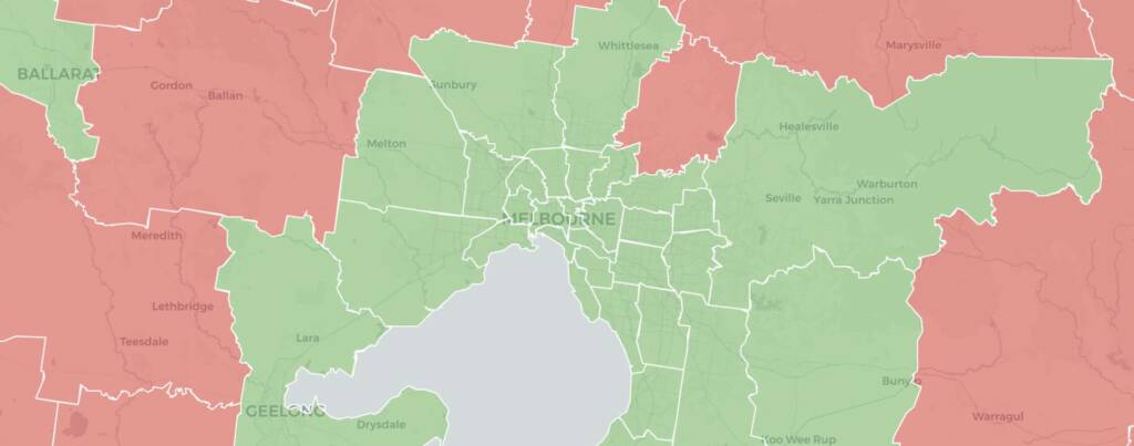
This guide will not cover all 79 local government areas in Victoria: instead I have profiled the 33 most populous councils. This is every council with a population of 85,000 or more, as of 2021.
These 33 councils cover just over 80% of the state’s population as of the 2021 census. There were 5.28 million people living in this area, which made up 81.3% of the total population.
This guide is a bit experimental and has taken a lot longer to write each guide than would normally be the case for an electorate guide. It would presumably be easier a second time once I have a previous guide to assist.
Part of the reason I had not previously profiled Victorian councils is because partisan affiliations are much looser and harder to define. Lots of candidates and councillors are members of political parties, and in some cases are officially endorsed by their party, but the Electoral Commission has a limited role in registering that party status – there is no party name on the ballot paper or in the results data. Candidate surveys do register if a candidate is endorsed by a party, but this information is hard to access and certainly not available prior to 2024. The use of postal voting has also meant that you can’t publish booth maps.
For each guide I have included a list of councillors, with their partisan affiliation outside of all-independent councils, a description of the wards of the council, and of the changes where the wards have been redrawn. I have also included short historical sections and tried my best to summarise which faction or group of councillors seems to be in control of a council by analysing how councillors have voted on mayoral ballots, although I have only been able to do this for the 16 biggest councils. After that I ran out of time.
In some councils I have been able to include a table of results for each party group in the council, but only where I have felt confident that I have been able to identify all of the party members running. In many councils that wasn’t the case, so I didn’t publish incomplete figures. My thanks to Leo Puglisi and whoever has been working on publishing election results on Wikipedia for this.
I have not published any results maps for the previous council elections, but I have redistributed the results of the 2022 federal election to the new wards and have included a map showing how those votes break down by ward.
This guide has been a tremendous effort and I have only had the time to work on it thanks to the support of donors via Patreon. If you find this guide useful please consider signing up for $5 per month. I will not be paywalling any of these profiles for this election cycle.
This map shows the councils which have been profiled in green. You can click on a council to find the link to the profile, along with some other information.
Contact
If you have a correction or an update for a single electorate page, feel free to post a comment. You can also send an email by using this form.
If you’d like me to include a candidate name or website link in my election guide, please check out my candidate information policy.